Business Objective
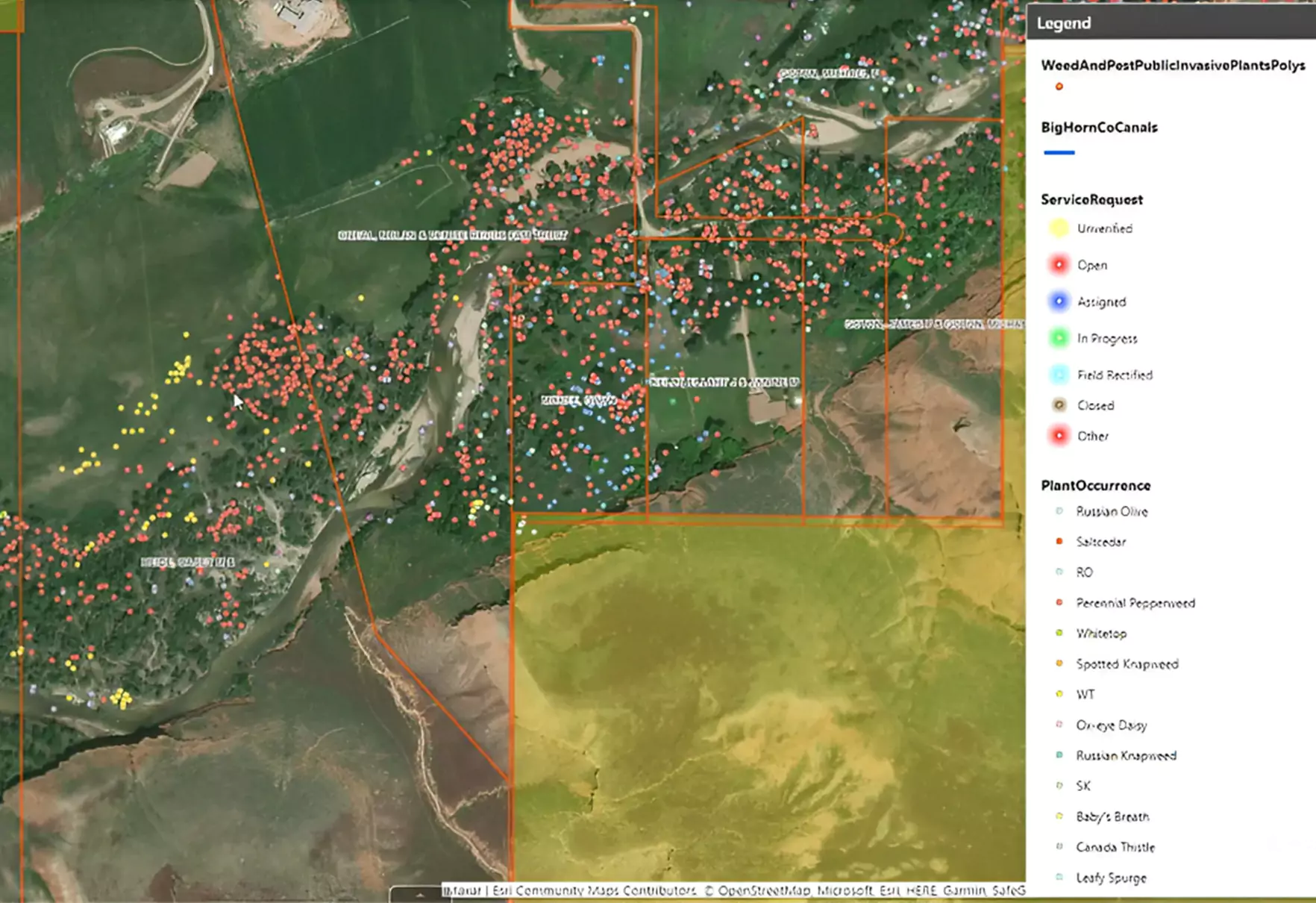
Our client is a trusted leader in precision measurement and geospatial solutions, serving geospatial and construction industries and focusing on precision measurement and spatial awareness for over three decades. The increasing density of invasive plants has always been a challenge. Such plants outcompete native plants for resources such as sunlight, water, and nutrients. Hence, the client wanted us to develop a ‘practical solution to noxious weeds’ through an application. Our client collaborated with Successive Digital to develop an all-in-one cross-platform application, ‘Invasive Plants,’ for govt and private contractor entities that manage the county's noxious weed control activities. The application also records and views field activities related to chemical and mechanical plant treatments, plant assessments, plant occurrences, proposed treatment areas, and service requests.
Business Challenges
Threat Posed By Noxious Weeds
Growing noxious weeds pose a significant threat to the vegetation. Hence, the client wanted to develop an application for tracking and managing weed control activities for county weed control.
Data Integration
Integrating the app with county databases and GIS systems requires careful planning and coordination to ensure data consistency and accuracy.
User Adoption
Encouraging govt entity technicians and private contractors to adopt the Invasive Plants app was challenging due to unfamiliarity with mobile technology or existing workflow.

Business Solutions
The client teamed up with Successive Digital, seeking the development of an easy-to-deploy cross-platform mobile app that efficiently manages noxious weed control activities. The app can be easily deployed through the Apple Store, Google Play Store, and Windows Store and supports real-time connectivity with offline editing capabilities. Our team devised a two-part approach to helping the client develop a comprehensive solution. First, we leveraged Xamarin. Forms and .Net to build native user interfaces for mobile apps using a single codebase. Later, we provided a predictable, high-quality process for managing support and maintenance issues. To enable county-level government weed management technicians and private contractors to visualize service requests and treatment areas, we integrated ESRI maps for seamless real-time data, dynamic entities, 3D base maps, and data filtering within the application. With features such as aerial imaging, technicians can identify and map areas infested with weeds and targeted management strategies.
Contact⟶Key Features
- Offline accessibility of the application
- Seamless “Raise Service Request” feature
- Treatment at any location with the help of Product Inventory
- Easy field scouting on the given map
- Easy calculation of Product amount with the help of the Product Calculator
- Graph data view for a quick overview of requests in the last 7 or 30 days
- Powerful Geospatial Analysis
- Real-Time Tracking
- Integration with IoT and Sensor Data
Business Outcomes
We Create a Valuable Difference
accuracy was achieved in customized weed management plans tailored to specific areas and plant occurrences.
35%
cost saving through dynamic reports and data visualization within the application
250%
Our Work
Delivering Innovation with Disruptive Technologies See All

Product Engineering
Facilitated Digital Commerce Transformation for a Leading Audio & Wearable Brand
We helped the client transition to Shopify headless architecture, implemented a MACH-aligned commerce stack, and streamlined their workflows, leading to 3x operational efficiency and a […]
Read more
Data & AI
How Did PlanHub Revolutionize Subcontractor Onboarding Using AI?
A Case Study on AI-Powered Data Parsing & Trade Mapping | October 2025
Read more
Product Engineering
Developed a Mobile Application for a Leading Apparel Brand
We helped the client build a customized mobile application based on Shopify headless, which led to a 42% increase in mobile-based conversions & significant boost […]
Read moreSuccess Stories
Logics LLC, USA
We have been continually working with technology experts at Successive. I appreciate them looking at our infrastructure to provide suggestions and I’m very impressed with their growth in recent years.
Ben Van Zutphen
Founder & CEO
CRE Models, USA
We worked on our first project 6 years ago, our business invests in real estate technology companies and we use their services for all the subsidiary companies that we invest in. I highly recommend them for any requirement you may have in the technical world.
Mike Harris
Managing Director
EWP, USA
When we first got in touch with Successive, we were looking to develop a sophisticated search technology integrated with an AI software system. It was a highly complex project that required a lot of adroitness which is exactly what Successive provided us with.
Myles Levin
President
PlayBetr, USA
We have been delighted working with Successive Digital. They helped us achieve and exceed our business goals. From Laravel, Json, Node to any technology or feature, the team delivered extreme standardization, excellence, and streamlined automation. Thumbs up to Sid and his team.
Marvin Jones
Director
Frontier Precision, USA
The process of Successive Digital is extremely smooth and commendable. I loved the upfront communication, well-organized sprints and immersive documentation, especially the Redmine system, to track daily progress easily. We are looking forward to working with Successive on our upcoming projects too.
Chad Minteer
CEO
Display Now, USA
I am extremely grateful to Successive Digital for being a wonderful and strategic partner. The team promptly understood the concept, took daily mockups, presented a comprehensive set of specifications, turned them into designs and built a scalable solution. It’s been awesome working with you guys


